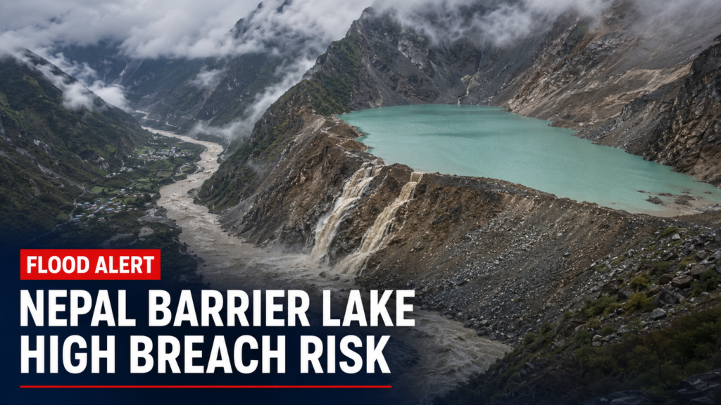
KATHMANDU, August 27: Nepal is facing a renewed flash-flood threat after a large barrier lake formed near the confluence of the Chhochen Khola and Purepu Tsangpo rivers close to the Nepal–Tibet border, prompting China to warn that the natural dam carries a high risk of breaching over the next three days.
China’s Ministry of Water Resources estimated that the lake held about 2 million cubic metres of water on Thursday morning. Authorities expect approximately 3 million cubic metres of additional inflow during the following three days as rain continues in the Himalayan border region.
Chinese state media reported that water had already begun overflowing from the lake. Officials are monitoring the natural dam’s stability and modelling the path and force of a possible outburst flood to support evacuations, rescue operations and emergency planning.
- Location: Near the Chhochen Khola–Purepu Tsangpo confluence in the Nepal–Tibet border region.
- Estimated stored water: Around 2 million cubic metres as of August 27 morning.
- Forecast inflow: About 3 million cubic metres over the next three days.
- Risk: Chinese water authorities assess the possibility of a breach as high.
- Potential downstream corridor: The Bhote Koshi and Trishuli river system, including already flood-hit border areas.
Why the new barrier lake is dangerous
A barrier lake forms when landslide debris, rock, ice or mud blocks a river and creates a temporary natural dam. Such dams can be highly unstable because they have not been engineered to withstand increasing water pressure.
If the blockage erodes gradually, water may drain without a major disaster. If it fails suddenly, however, a concentrated wall of water, sediment and debris can rush downstream with little warning. The danger is especially serious in steep Himalayan valleys, where narrow channels can accelerate the flow and expose settlements, bridges, roads and hydropower facilities.
The expected 3 million cubic metres is an estimate of incoming water, not necessarily the lake’s final stored volume, because some water is already spilling out. The breach risk depends on several factors, including rainfall, the strength and shape of the debris barrier, the rate of inflow and the speed at which overflow cuts through the blockage.
Bhote Koshi and Trishuli areas remain on alert
The rivers around the reported blockage feed the upper Bhote Koshi–Trishuli system. A sudden release could therefore threaten locations downstream of the border and complicate rescue work in Nepal’s Rasuwa district, where roads, bridges and settlements were damaged by the August 26 disaster.
Nepal’s Department of Hydrology and Meteorology has urged people in vulnerable areas along the Bhote Koshi and Trishuli corridors to remain in safe locations and follow official instructions. Access to some damaged routes has also been restricted while agencies assess the condition of river channels and unstable slopes.
China activates flood emergency response
China’s Ministry of Water Resources activated a Level-IV flood-control emergency response for Tibet at 1 pm on August 27. It directed regional authorities to closely track the barrier’s stability, changes in stored water, rainfall and river levels, while identifying people located within the potential inundation zone.
An expert team was sent to Gyirong County to assist with emergency management, and a hydrological monitoring unit was deployed to observe the lake and surrounding rivers. Authorities said flood simulations and impact assessments would be used to support possible evacuations and downstream relief operations.
New danger complicates rescue operations
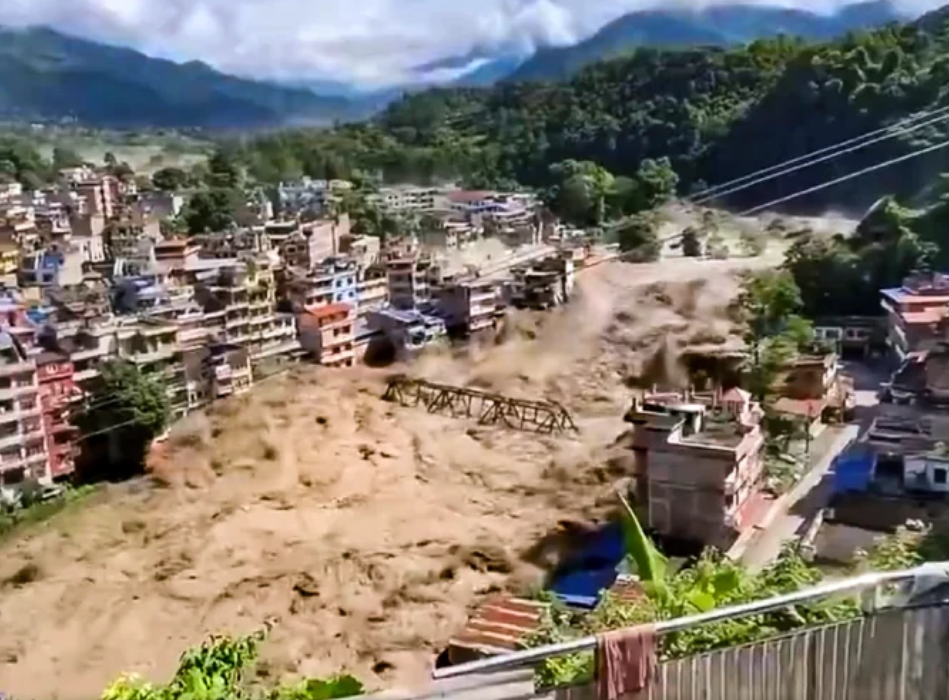
The warning comes one day after a destructive surge of water, mud, rock and ice swept through the Nepal–Tibet border region. The disaster caused heavy loss of life, destroyed infrastructure and left many residents, tourists and pilgrims unaccounted for.
Rescue teams are still searching damaged settlements and isolated routes. A secondary flood could force personnel to withdraw from exposed riverbanks, delay access to affected communities and create new risks for families waiting for information about missing relatives.
Casualty and missing-person figures remain fluid as Nepalese and Chinese authorities reconcile reports from remote areas. For that reason, the latest verified official bulletin should be used for any updated toll rather than combining figures from different publication times.
Safety advice for downstream communities
Residents, travellers and rescue volunteers in potentially affected valleys should rely on Nepal’s disaster-management agencies, the Department of Hydrology and Meteorology, local administrations and security forces for evacuation instructions. People should avoid riverbanks, damaged bridges, low-lying roads and unofficial attempts to view the lake or flood channel.
Those already in safe locations should keep phones charged, carry identity documents and essential medicines, and be prepared to move immediately if sirens, mobile alerts or local officials issue an evacuation order. Rumours and unverified social-media claims about the timing of a breach should not be treated as official warnings.
This is a developing story. Details may change as new hydrological observations and government advisories are released.